-
 Organization(s): USDAResource Type: Organization Webpage
Water Vision 2050 takes aim at the greatest threats to water availability and sustainable agriculture, including climate change and the increasing global population. It puts forward recommendations for critical research and water management actions.
Region: US National -
 Organization(s): CEQResource Type: Data and Software
The tool has an interactive map and uses datasets that are indicators of burdens in eight categories: Climate change, energy, health, housing, legacy pollution, transportation, water and wastewater, and workforce development.
Region: -
 Organization(s): USGCRPResource Type: Data and Software
The Climate Resilience Information System (CRIS) provides access to federal decision-relevant information, enabling users to easily find and customize information for their need.
Region: US National -
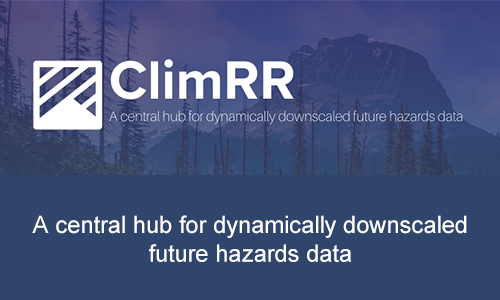 Organization(s): DOEResource Type: Data and Software
ClimRR provides data about future conditions and environmental extremes to help plan and adapt for the future. Using one of the world's largest supercomputers, ClimRR datasets provide among the most comprehensive, free, and dynamically downscaled projections for the United States.
Region: US National -
 Organization(s):Resource Type: Organization Webpage
The Colorado River Science Wiki is a web-based clearinghouse for scientific and technical information relevant to the Colorado River Basin and the management of its water resources and related natural resources. This clearinghouse is intended to be useful to managers and other decision-makers, researchers, the media, and the broader public.
Region: Southwest -
 Organization(s): NSFResource Type: Data and Software
The Community Surface Dynamics Modeling System (CSDMS) deals with the Earth's surface—the ever-changing, dynamic interface between lithosphere, hydrosphere, cryosphere, and atmosphere. CSDMS is a diverse community of experts promoting the modeling of earth surface processes by developing, supporting, and disseminating integrated software modules that predict the movement of fluids, and the flux (production, erosion, transport, and deposition) of sediment and solutes in landscapes and their sedimentary basins.
Region: -
 Organization(s): DOEResource Type: Community of Practice Portal
DOE's Coastal Observations, Mechanisms, and Predictions Across Systems and Scales-Great Lakes Modeling (COMPASS-GLM) will help dramatically enhance predictive understanding of coastal systems, including their response to short- and long-term changes.
Region: Great Lakes - IHTM testbed, Midwest -
 Organization(s): NSF, USGSResource Type: Data and Software
CONUS404 is a unique, high-resolution hydro-climate dataset appropriate for forcing hydrological models and conducting meteorological analysis over the contiguous United States. It was produced by the Weather Research and Forecasting (WRF) Model simulations run by National Center for Atmospheric Research (NCAR) as part of a collaboration with the U.S. Geological Survey (USGS) Water Mission Area.
Region: CONUS -
 Organization(s): NSF, USBR, USACEResource Type: Data and Software
This archive of statistically downscaled climate projections was developed using three downscaling techniques (monthly BCSD, daily BCCA , and daily LOCA). Both CMIP3 and CMIP5 hydrology projections are available.
Region: CONUS -
 Organization(s): DOEResource Type: Data and Software
Repositories associated with the E3SM Project.
Region: US National -
 Organization(s): DOEResource Type: Newsletter
Newsletter of E3SM
Region: US National -
 Organization(s): DOEResource Type: Video
DOE's Energy Exascale Earth System Model (E3SM) is a state-of-the-science Earth system model development and simulation project to investigate energy-relevant science using code optimized for DOE's advanced computers.
Region: US National -
 Organization(s): DOEResource Type: Community of Practice Portal
DOE's Energy Exascale Earth System Model (E3SM) is a state-of-the-science Earth system model development and simulation project to investigate energy-relevant science using code optimized for DOE's advanced computers
Region: US National -
 Organization(s): DOEResource Type: Organization Webpage
Earth and Environmental Systems Modeling (EESM) is a program for the Earth and Environmental Systems Sciences Division in the Office of Biological and Environmental Research within the Department of Energy's Office of Science. EESM consists of three research program areas: Earth System Model Development, Regional & Global Model Analysis, and MultiSector Dynamics.
Region: US National -
 Organization(s): USACEResource Type: Organization Webpage
Engineering With Nature is the intentional alignment of natural and engineering processes to efficiently and sustainably deliver economic, environmental, and social benefits through collaboration.
Region: -
 Organization(s): EPAResource Type: Organization Webpage
EPA’s water research supports solutions that ensure adequate supplies of clean water resources to protect our health and livelihood, protect and restore watersheds and ecosystems, and strengthen our economy.
Region: US National -
 Organization(s): FEMAResource Type: Organization Webpage
The Federal Emergency Management Agency's (FEMA) vision for the Future of Flood Risk Data Initiative (FFRD) marks a substantial advancement in data availability and analysis to support floodplain regulation, management, and risk communication.
Region: CONUS -
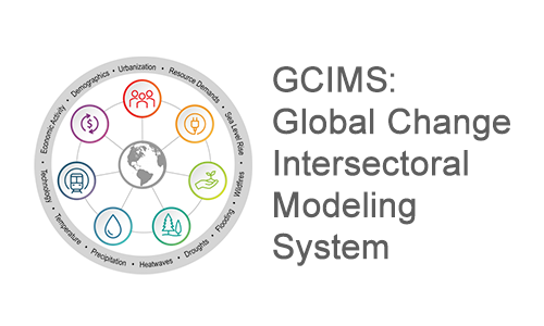 Organization(s): DOEResource Type: Community of Practice Portal
The goal of the Global Change Intersectoral Modeling System (GCIMS) scientific focus area is improving the understanding of the complex interactions among energy, water, land, climate, socioeconomics, and other important human and natural systems at regional to global and seasonal to centennial scales.
Region: US National -
 Organization(s): NASAResource Type: Organization Webpage
The goal of the Global Land Data Assimilation System (GLDAS) is to ingest satellite- and ground-based observational data products, using advanced land surface modeling and data assimilation techniques, in order to generate optimal fields of land surface states and fluxes.
Region: Global -
 Organization(s): NASAResource Type: Data and Software
Global retrospective estimates of land and hydrology variables at 5-km resolution.
Region: Global -
 Organization(s): NASAResource Type: Data and Software
The GRACE twin satellites (GRACE / GRACE-FO) are making detailed measurements of Earth's gravity field changes and collect information about Earth's water reservoirs over land, ice and oceans, as well as earthquakes and crustal deformations.
Region: Global -
 Organization(s): NASAResource Type: Data and Software
Weekly updated drought/wetness maps based on the assimilation of Gravity Recovery and Climate Experiment (GRACE) and GRACE Follow On (GRACE-FO) data into a land surface model.
Region: CONUS, Global -
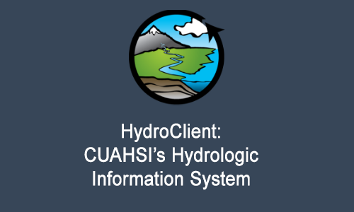 Organization(s): CUAHSIResource Type: Data and Software
CUAHSI’s HydroClient data portal provides access to more than 100 data sources, including over 5 million unique time series, from federal agencies, university researchers, and volunteer science groups through a single map interface. Use HydroClient to search, preview, and download time series environmental data such as streamflow measurements, meteorological data, repeated grab sample results, and soil moisture measurements. To learn more, see the HydroClient User Guide.
Region: -
 Organization(s): NSFResource Type: Data and Software
HydroFrame is a platform that facilitates easy interaction with large computationally intensive hydrologic models and massive simulated outputs. The tools enable users to subset model inputs and outputs for any watershed in the United States and to develop their own models.
Region: