-
 Organization(s): CUAHSIResource Type: Data and Software
The HydroShare Data Repository enables archival and discovery of multiple types of water data, including time series data, GIS data, models and more, in a citable manner. HydroShare offers extensive capabilities for managing scientific data, including private and public collaboration, cloud analysis, science dissemination, and formal data publication.
Region: -
 Organization(s): DOEResource Type: Community of Practice Portal
HyperFACETS: A Framework for Improving Analysis and Modeling of Earth System and Intersectoral Dynamics at Regional Scales project aims to address the questions: How much can we trust given earth system information for actionable science? And how can we ensure its saliency?
Region: US National -
 Organization(s): DOEResource Type: Community of Practice Portal
The Integrated Multisector, Multiscale Modeling (IM3) project is a multi-institutional effort led by Pacific Northwest National Laboratory and funded by the U.S. Department of Energy’s Office of Science as part of the MultiSector Dynamics program area within the Earth and Environmental Systems Modeling program.
Region: US National -
 Organization(s): DOEResource Type: Community of Practice Portal
ICoM is a multi-institutional effort led by the Pacific Northwest National Laboratory and funded by the U.S. Department of Energy (DOE). ICoM is taking an integrated approach that brings together multiple modeling tools to represent both extreme events and long-term changes in human and natural systems.
Region: Mid-Atlantic - IHTM testbed, Northeast -
 Organization(s): NASAResource Type: Data and Software
The IMERG algorithm combines information from the GPM satellite constellation to estimate precipitation over most of the Earth's surface. It is particularly valuable in areas that lack ground-based precipitation-measuring instruments, such as oceans and remote areas.
Region: Global -
 Organization(s): DOEResource Type: Community of Practice Portal
The Interdisciplinary Research for Arctic Coastal Environments (InteRFACE) project focuses on how the coupled, multiscale feedbacks among land processes (permafrost thaw, hydrology, and erosion), sea ice (morphology and coupling), ocean dynamics (stratification, waves, and tides), coastal change (erosion, deposition, and flooding), marine biogeochemistry, and human systems (transportation, resource availability and extraction, and settlements) will control the trajectory and rate of change across the Arctic coastal interface.
Region: US National -
 Organization(s): DOEResource Type: Data and Software
A collaborative data and computational platform for the MultiSector Dynamics Community project.
Region: -
 Organization(s): DOEResource Type: Community of Practice Portal
The MIT Joint Program on the Science and Policy of Global Change: Multi-Sector Dynamics project conducts actionable, evidence-based research to improve understanding of sustainability challenges. Research enables decision-makers to devise effective strategies to address global change. Researchers take an integrated approach to sustainability science that considers the Earth's interconnected, co-evolving natural and societal systems in their full complexity.
Region: US National -
 Organization(s): NASAResource Type: Data and Software
Modern Era Retrospective-analysis for Research and Applications Version 2 (MERRA-2) is a global atmospheric reanalysis (1980-present) that assimilates the latest NASA observations and many standard meteorological observing systems. It represents many aspects of the weather and climate over the United States, along with the teleconnections that drive climate variability.
Region: CONUS, Global -
 Organization(s): DOEResource Type: Community of Practice Portal
Updates from the MSD Community of Practice.
Region: US National -
 Organization(s): DOE, MSDResource Type: Community of Practice Portal
Newsletter archive of the MSD Community.
Region: US National -
 Organization(s): DOEResource Type: Community of Practice Portal
The MSD community aims to improve our understanding of the coevolution of human and natural systems over time, and build the next generation of tools that bridge across sectors (energy, water, land, economy) and scales (spatial, temporal) as well as offer a holistic view of systems-of-systems.
Region: US National -
 Organization(s): DOEResource Type: Community of Practice Portal
MultiSector Dynamics seeks to advance scientific understanding of the complex interactions, interdependencies, and coevolutionary pathways of human and natural systems, including interdependencies among sectors and infrastructures. This includes advancing relevant socioeconomic, risk analysis, and complex decision theory methods to lead insights into Earth system science, while emphasizing the development of interoperable data, modeling, and analysis tools for integration within flexible modeling frameworks.
Region: US National -
 Organization(s): NASAResource Type: Organization Webpage
The Water and Energy Cycle focus area (WEC) supports focused and crosscutting research to improve our understanding of the global water cycle.
Region: -
 Organization(s): USGSResource Type: Data and Software
The USGS National Hydrologic Model (NHM) infrastructure supports the efficient construction of local-, regional-, and national-scale hydrologic models. The NHM infrastructure consists of: 1) an underlying geospatial fabric of modeling units with an associated parameter database, 2) a model input data archive, and 3) a repository of the physical model simulation code bases.
Region: -
 Organization(s): USGSResource Type: Organization Webpage
Substantial advances in water science, together with emerging breakthroughs in technical and computational capabilities, have led the USGS to develop a Next Generation Water Observing System (NGWOS). The USGS NGWOS provides real-time data on water quantity and quality in more affordable and rapid ways than previously possible, and in more locations.
Region: US National -
 Organization(s): NASAResource Type: Data and Software
Retrospective and real-time estimates of land and hydrology variables over North America at 1km resolution.
Region: CONUS -
 Organization(s): NSFResource Type: Organization Webpage
The Cyberinfrastructure for Sustained Scientific Innovation (CSSI) program seeks to enable funding opportunities that are flexible and responsive to the evolving and emerging needs in cyberinfrastructure (CI). The program continues to emphasize integrated CI services, quantitative metrics with targets for delivery and usage of these services, and community creation.
Region: -
 Organization(s): NSFResource Type: Organization Webpage
The NSF Geoinformatics Program supports the development of community cyberinfrastructure to advance research and education in the Earth sciences.
Region: -
 Organization(s): NSFResource Type: Organization Webpage
Supports research on water beneath and on the Earth’s surface as well as relationships of water with material and living components of the environment, with a focus on hydrologic processes and fluxes of water.
Region: -
 Organization(s): NASAResource Type: Data and Software
OpenET uses best available science to provide easily accessible satellite-based evapotranspiration (ET) data for improved water management across the western United States.
Region: Western U.S. -
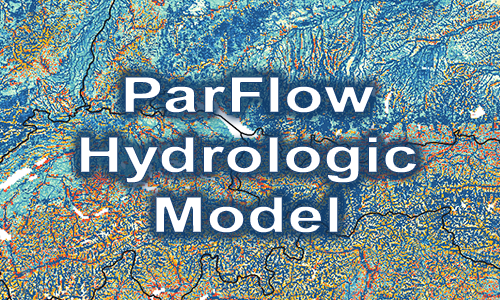 Organization(s): NSFResource Type: Data and Software
ParFlow is an open-source, community-integrated hydrology model that is freely available on GitHub. ParFlow is a numerical model that simulates the hydrologic cycle from the bedrock to the top of the plant canopy. It integrates three-dimensional groundwater flow with overland flow and plant processes using physically based equations to rigorously simulate fluxes of water and energy in complex real-world systems.
Region: -
 Organization(s): DOEResource Type: Community of Practice Portal
The Program on Coupled Human and Earth Systems (PCHES) is a transdisciplinary research consortium of nine leading universities. Funded under the U.S. Department of Energy's MultiSector Dynamics (MSD) program, the PCHES team focuses on driving innovations in modeling and analysis of multisector, multiscale land, energy, water, and infrastructure systems to advance understanding of complex risk and response behaviors.
Region: US National -
 Organization(s): USGSResource Type: Data and Software
StreamStats provides access to spatial analytical tools that are useful for water-resources planning and management, and for engineering and design purposes. The map-based user interface can be used to delineate drainage areas, get basin characteristics and estimates of flow statistics, and more. Available information varies from state to state
Region: CONUS